by ALLSTAR | Mar 1, 2022 | Botany, Cultural Resources, Mitigation & Restoration, News, Permitting, Stream & Wetland Permitting, Vegetation Management
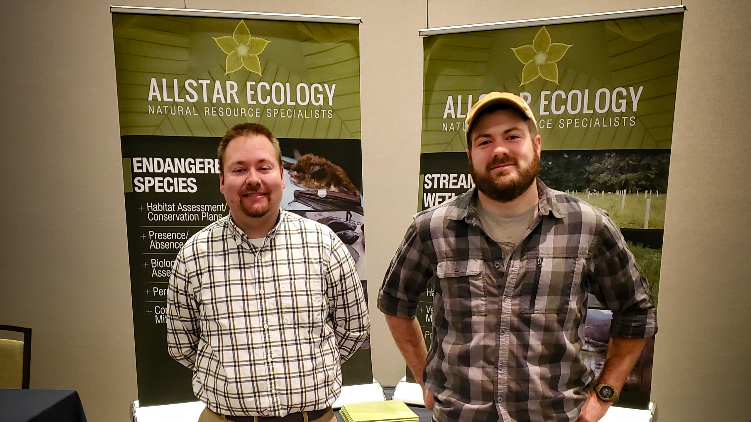
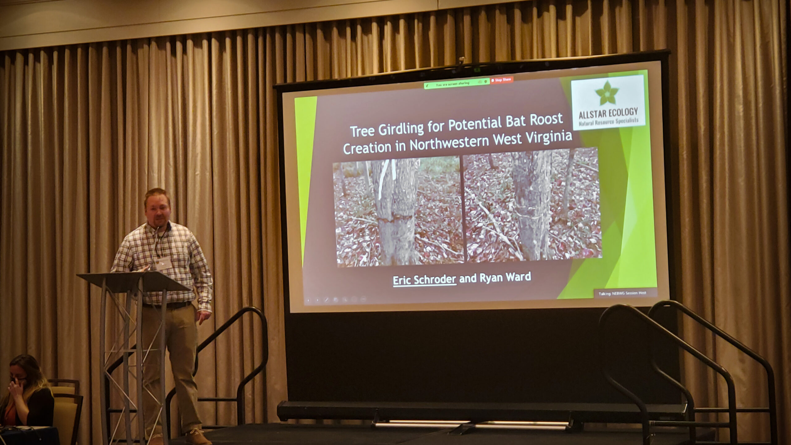
North Eastern Bat Working Group (NEBWG) Conference
Our Bat Crew delivered a presentation and poster at the NEBWG conference in January. They covered our findings for different methods of snag creation for bat roosting which took into account tree species, tree girdling methods, and time for a tree to be considered suitable based on decomposition. The study built on previously tested snag creation methods and sought to fill gaps by studying the time needed to create snags using two different methods across three genera of trees and determine the effect of tree species on the creation of snags when paired with the two methods. The findings were also published in the peer-reviewed, open-access journal Forests alongside other papers focusing on the “Effects of Forest Management Practices on Bat Habitat and Community Structure.” The paper can be found here for more details.
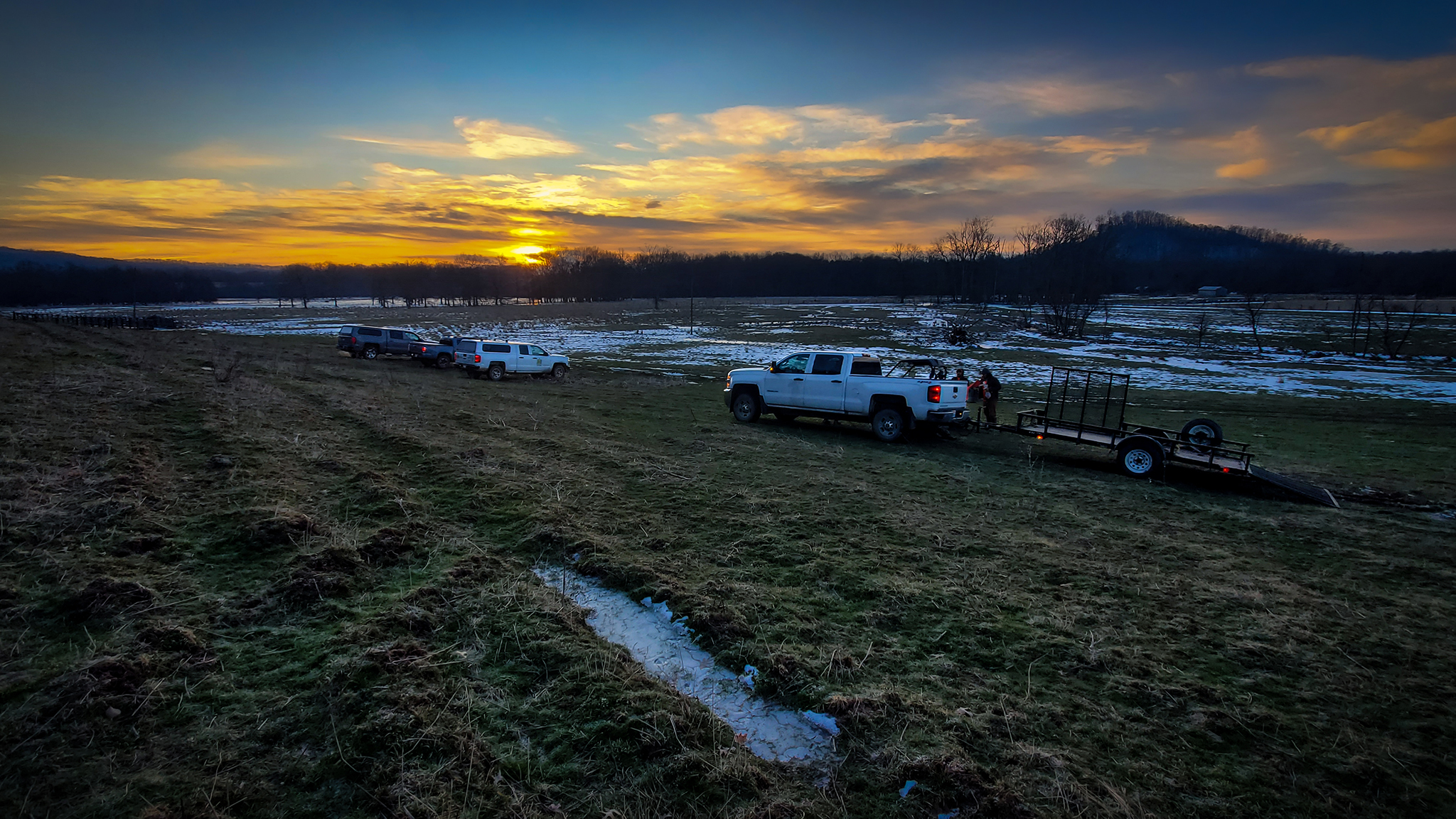
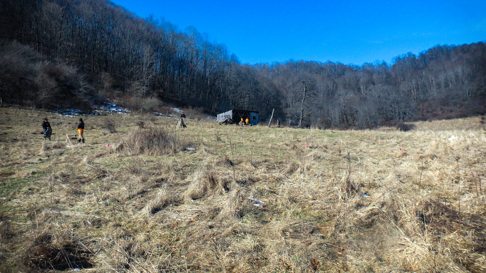
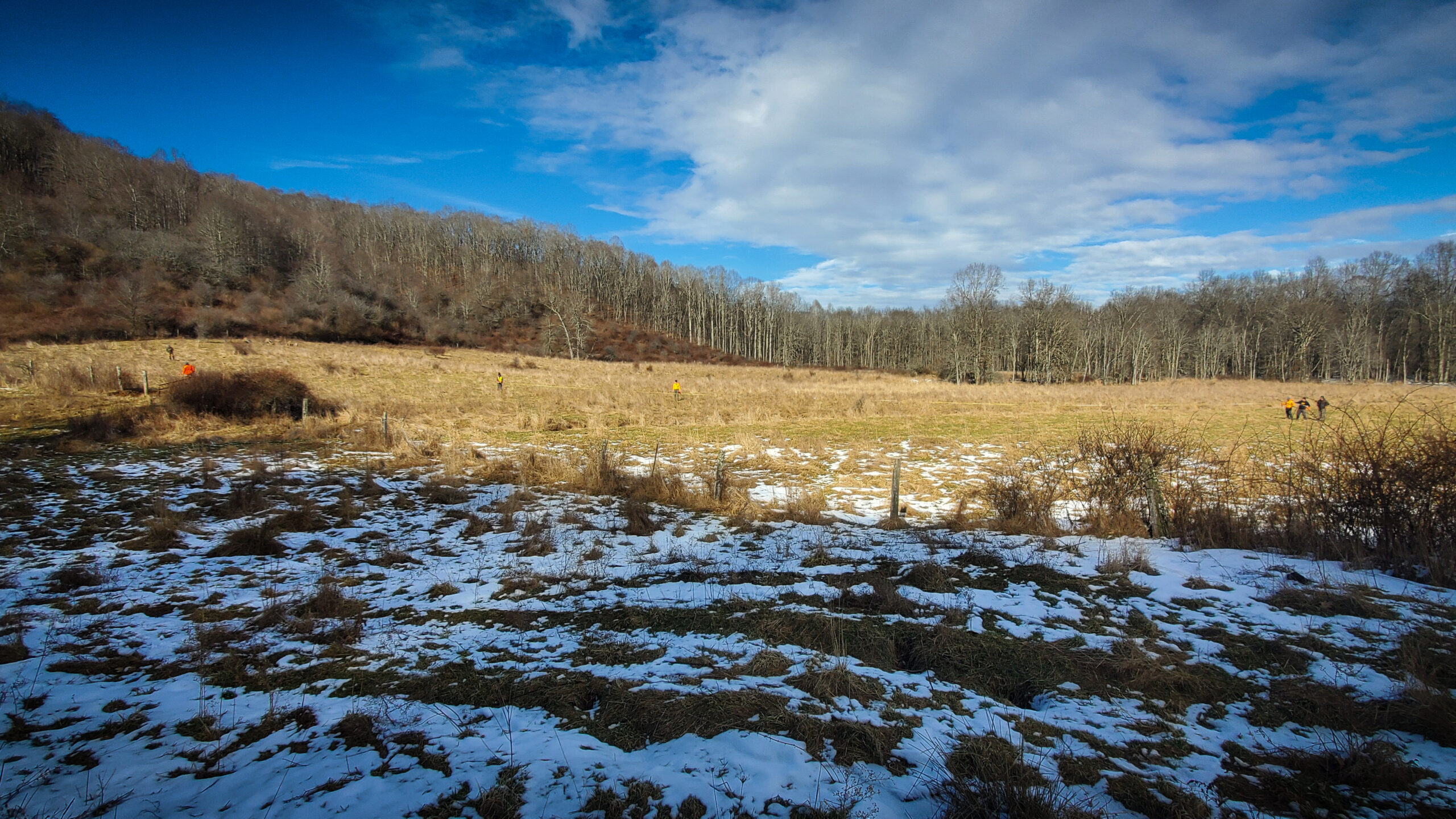
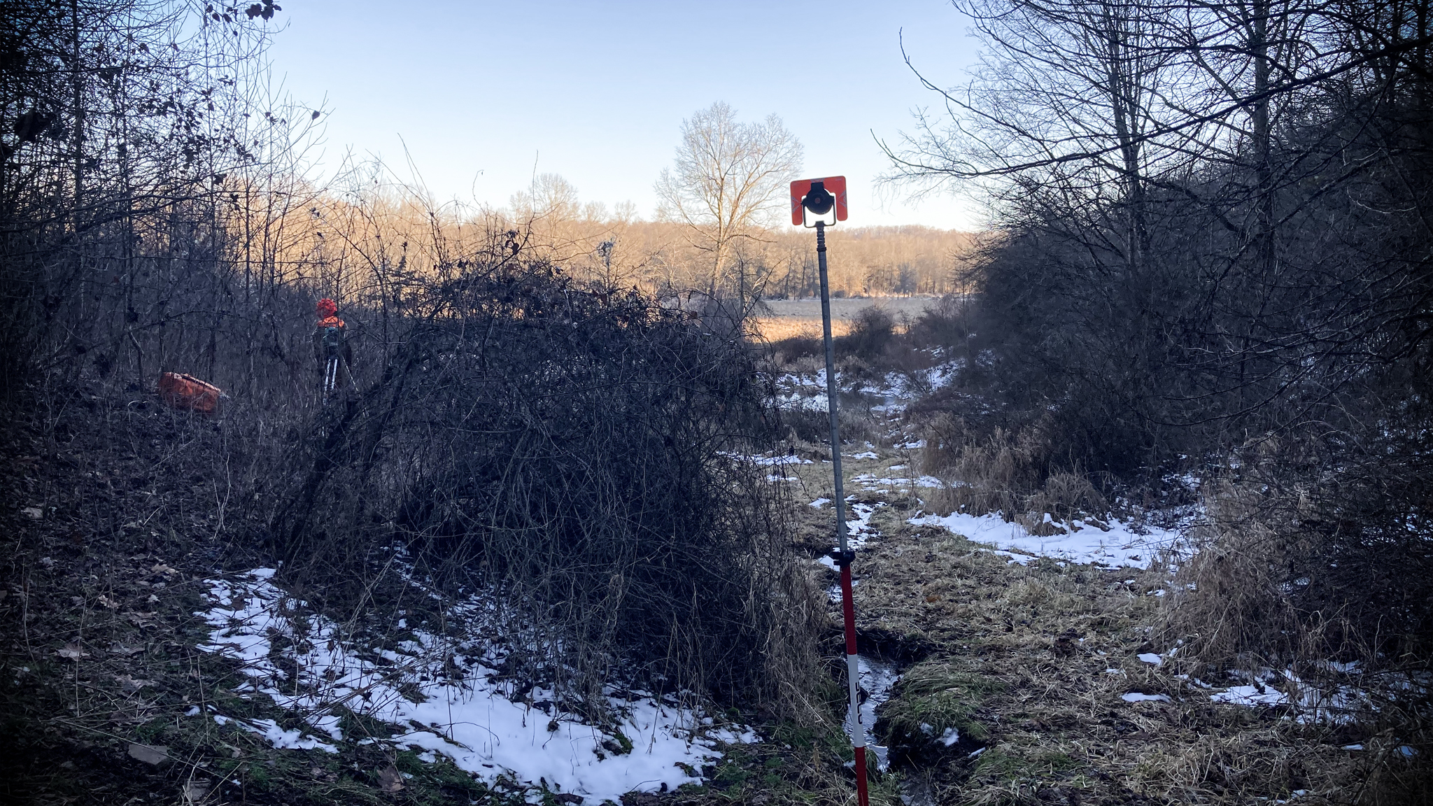
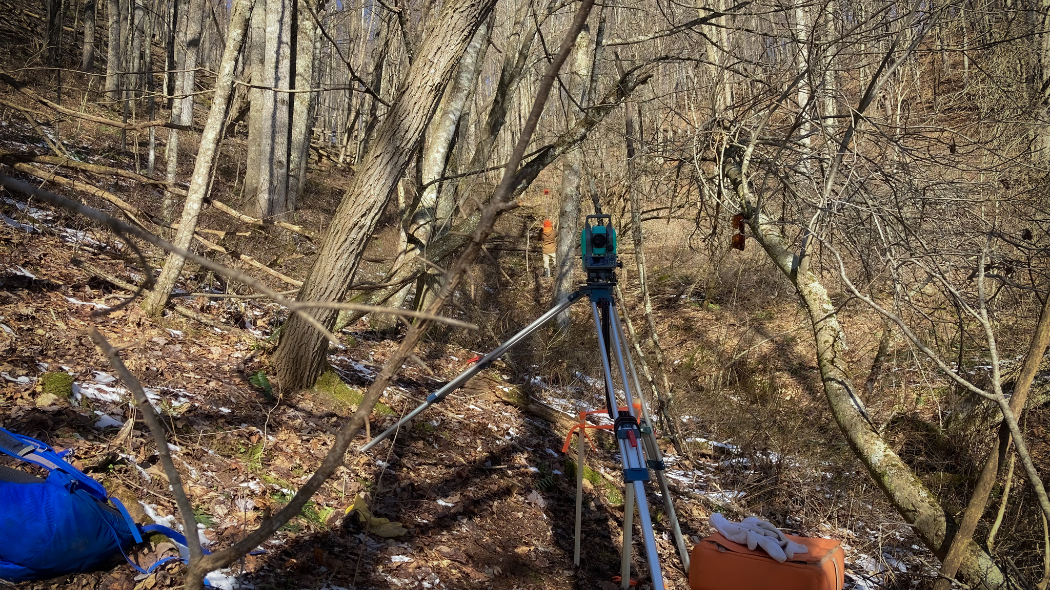
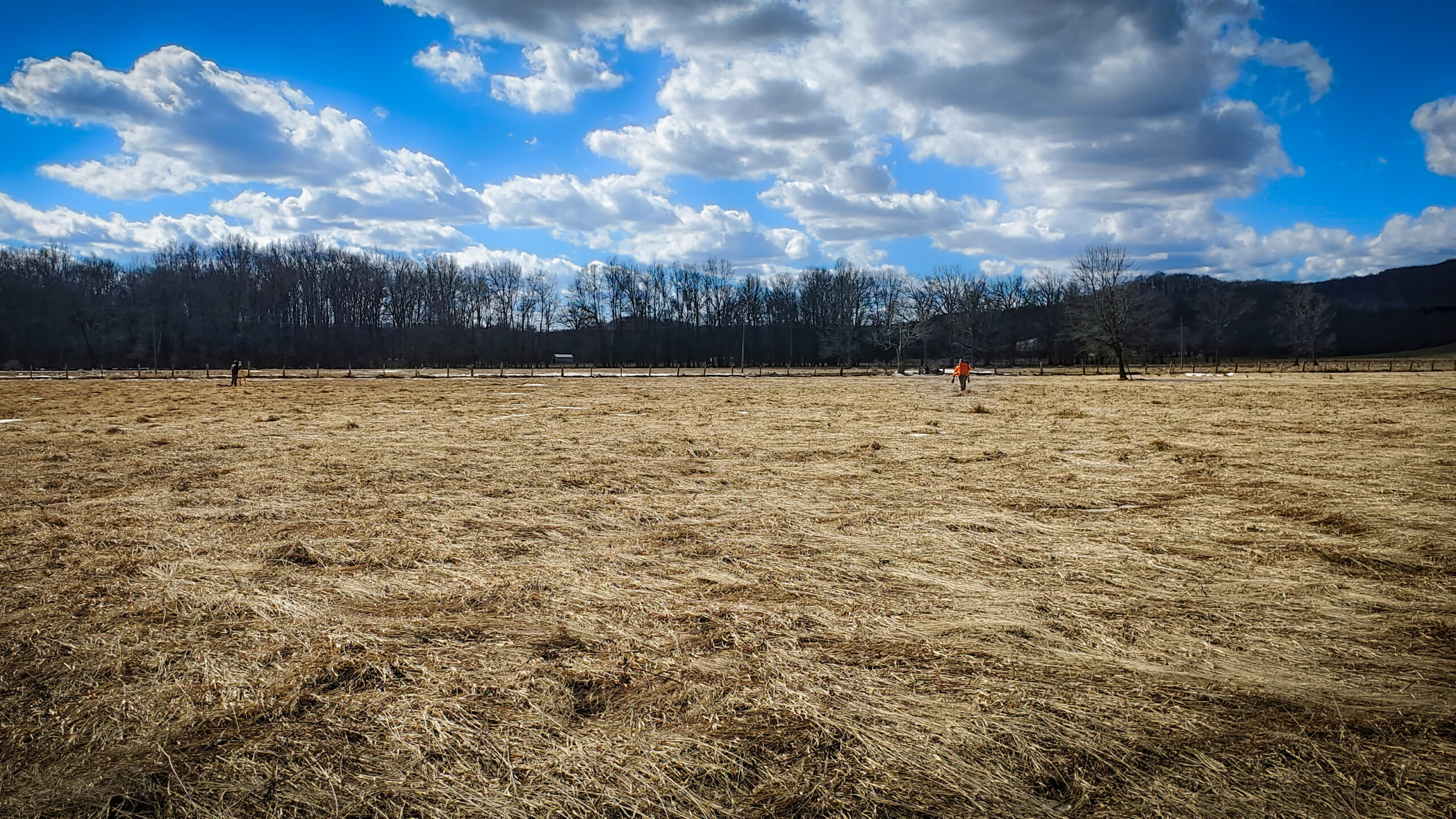
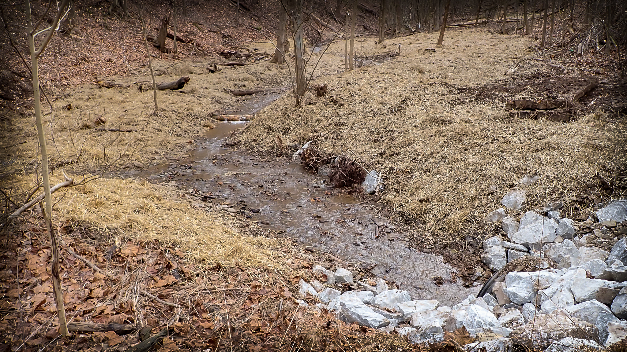
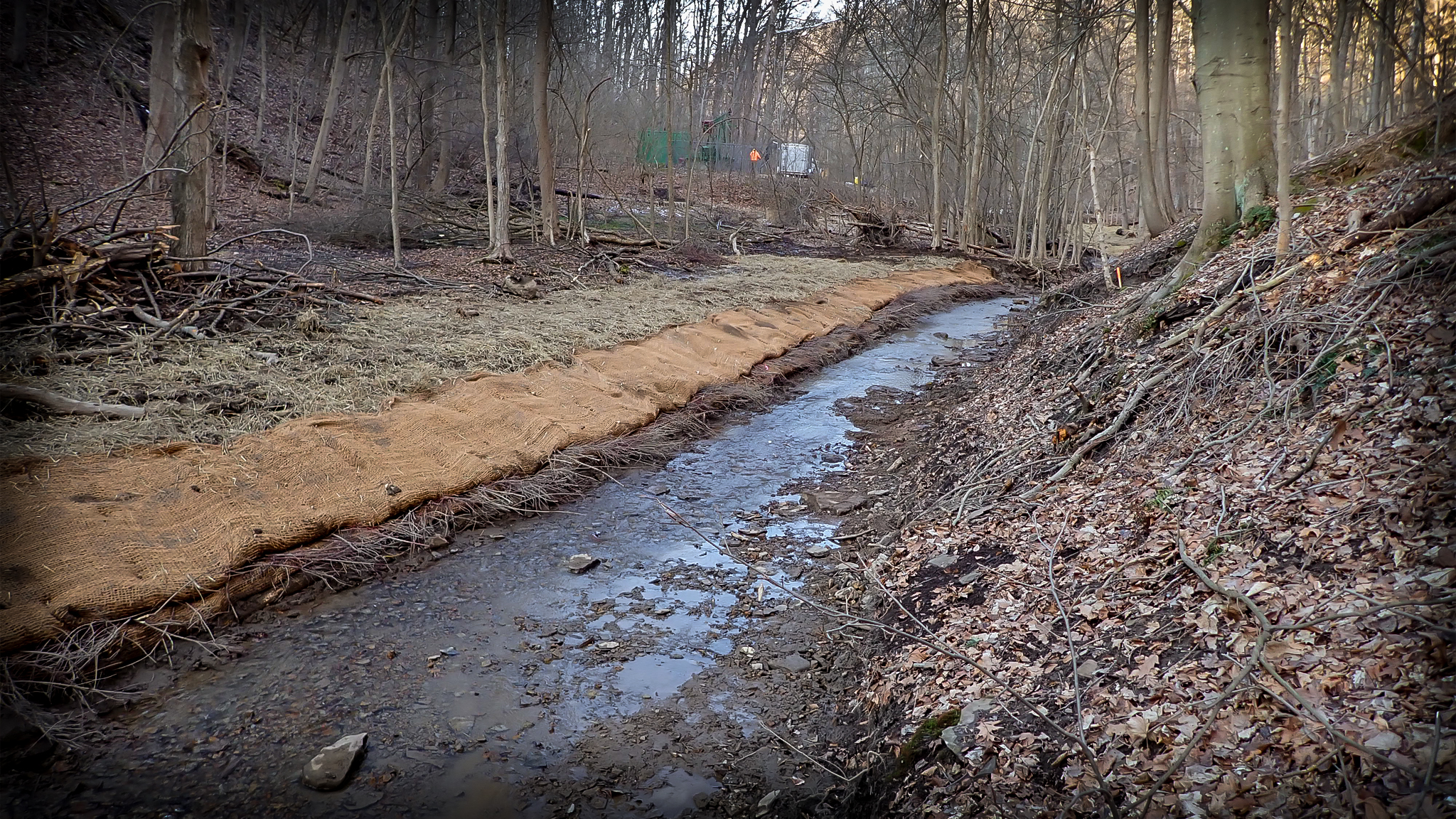
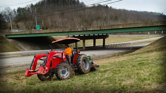
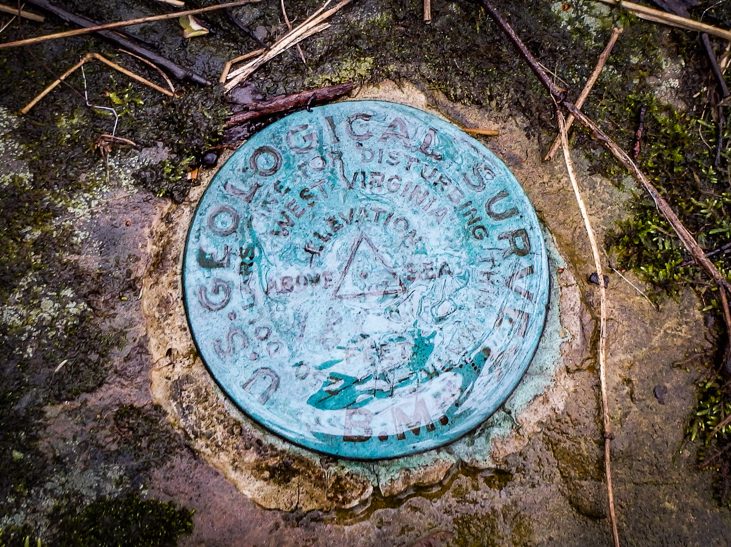
Greenbrier County Mitigation Bank Existing Conditions Survey
In February, we were back at it in Greenbrier County to gather topographic and reference reach data to start our designs for the mitigation bank portion of land along the Meadow River. Our teams surveyed roughly 28.5 acres covering 3 valleys. These points help to field truth elevations and boundaries acquired from preliminary GIS data. After taking our almost 3,000 points back to the office, we will use reference data gathered from a nearby stable stream to begin designing for ~750 linear feet(LF) of restorative intervention along the original channel and the creation of ~3,000 LF of new channel to re-establish the historic morphology that has deteriorated over the years. We will also enhance ~3,900 LF of existing channel and preserve an additional ~1,000 LF of intermittent/ephemeral streams on site.
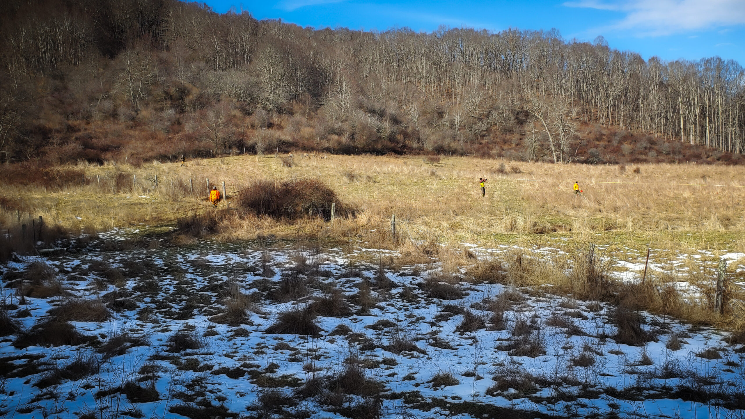
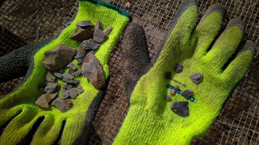
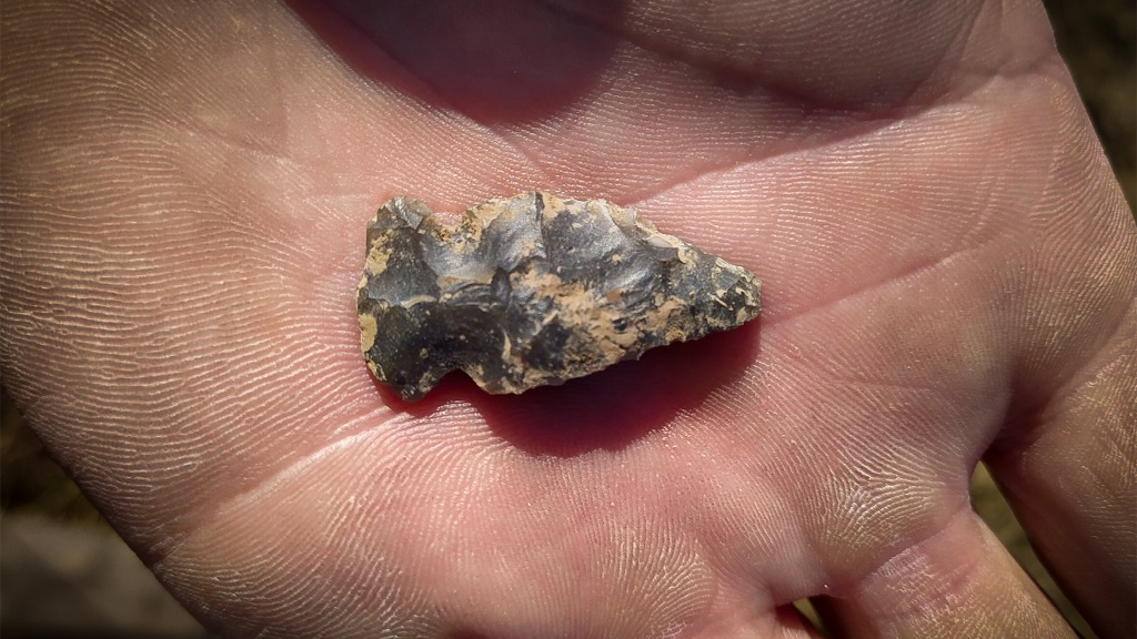
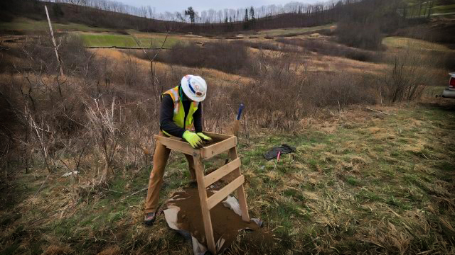
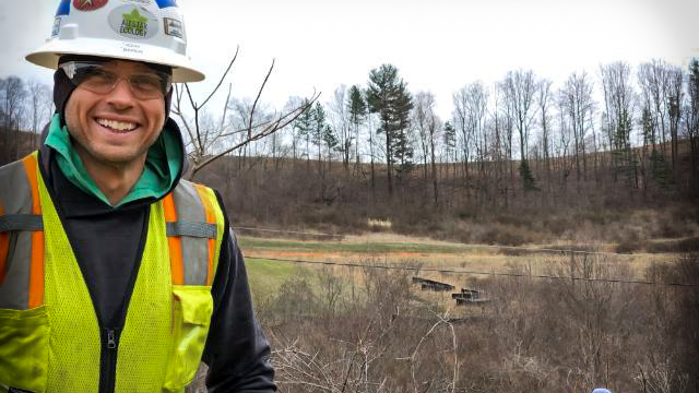
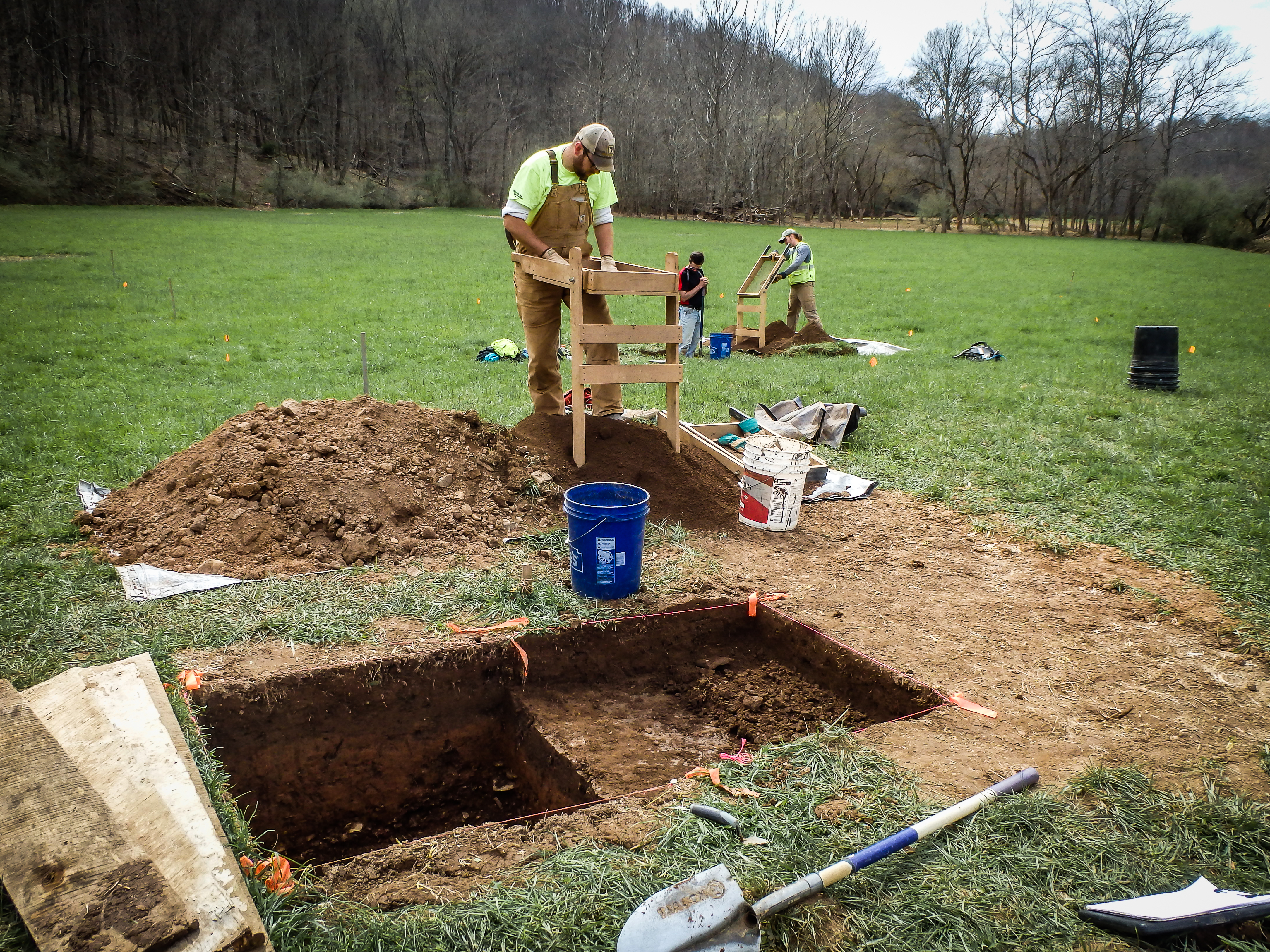
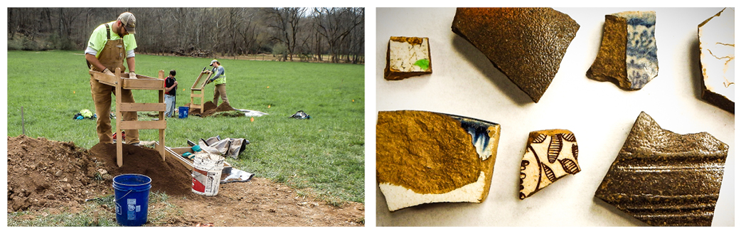
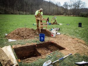
Greenbrier County Mitigation Bank Archeological Survey
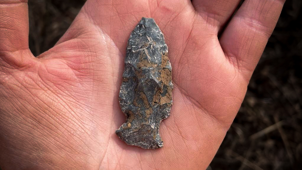
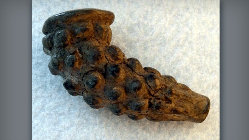
Our hardworking Archaeology Crew was right there alongside our Survey Crew doing a Phase I archaeology survey. Over the course of two weeks, they excavated 373 Shovel Test Probes (STPs) covering approximately 14.5 acres of testable area. From those, 77 positive STPs yielded several prehistoric stone tools and spearpoints, hundreds of flint flakes, a hammerstone, and several kilograms of Fire Cracked Rock (FCR). These STPs define the boundaries of three prehistoric lithic scatters and two isolated prehistoric finds which will allow for the development of the project to proceed while protecting our state’s cultural resources.
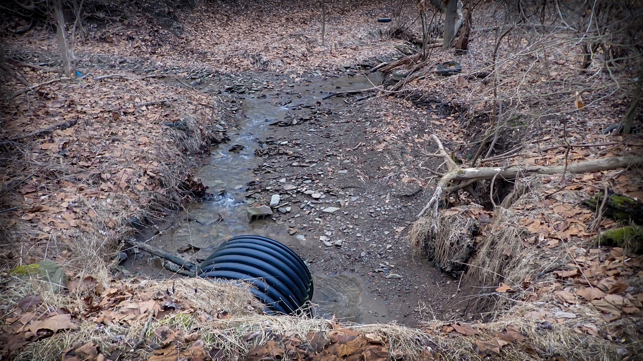
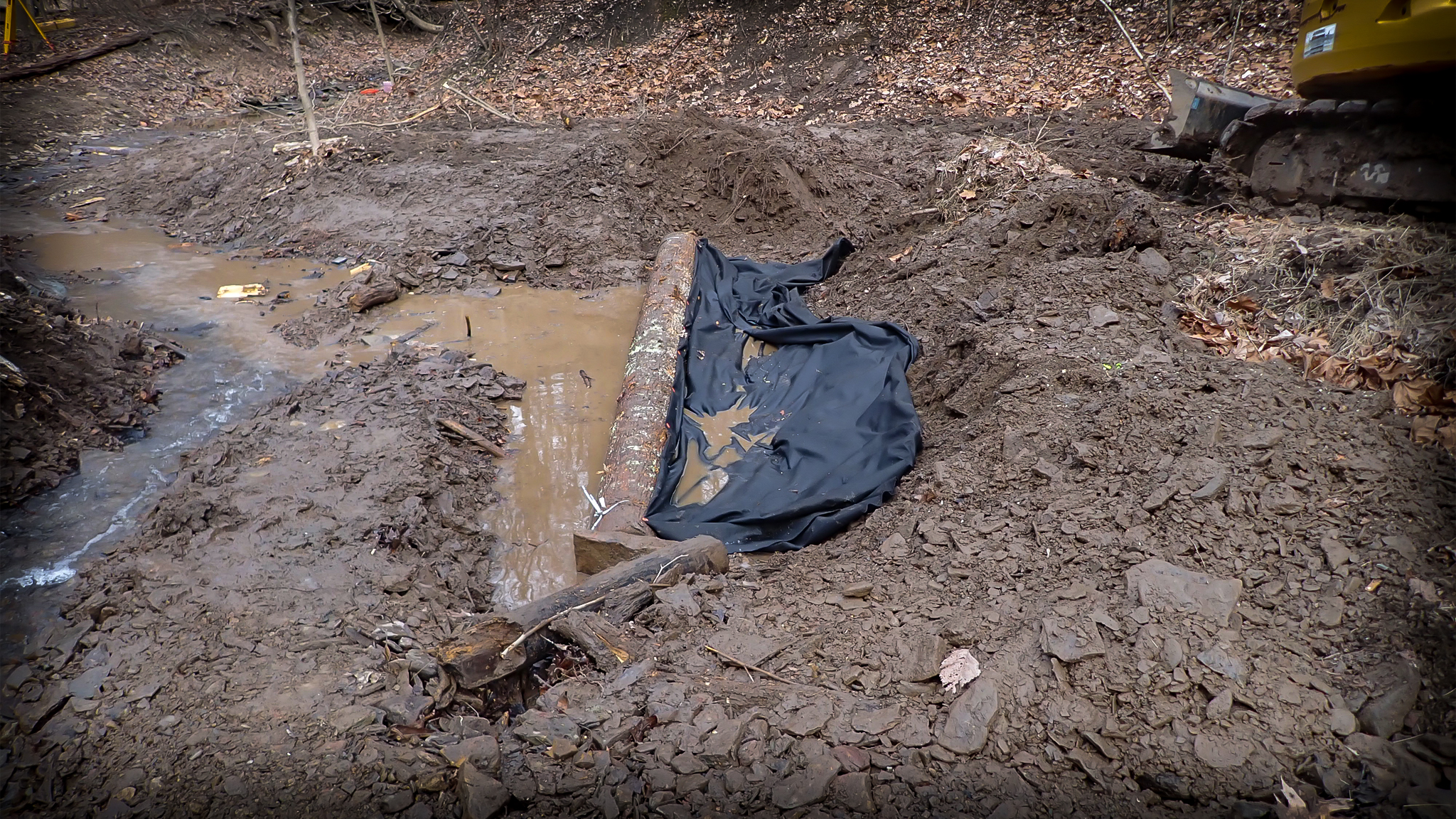
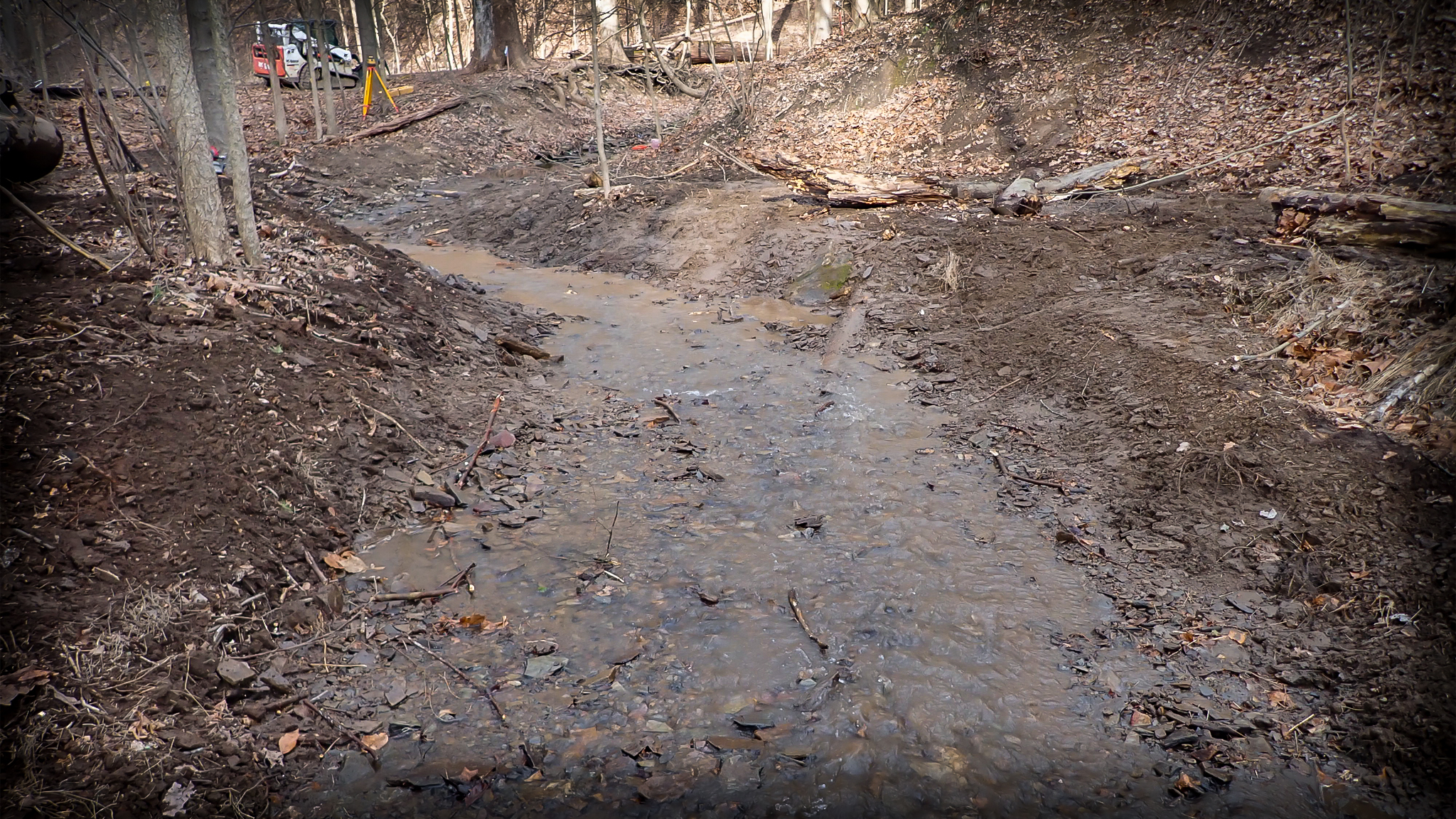
Tucker County Aquatic Organism Passage Enhancement
AllStar Ecology has been contracted to design an Aquatic Organism Passage Enhancement Project in Tucker County, WV. The project will involve removing existing degraded dual culverts and installing a pre-engineered bridge to daylight the stream and provide natural substrate and habitat for aquatic organisms including Brook Trout (Salvelinus fontinalis).
Upshur County Mitigation Bank Green Light
AllStar recently received the green light to begin work on a 40 acre mitigation bank in Upshur County which will cover 7,176 linear feet(LF) of stream intervention. Level 1, level 3, and creation intervention will make up 30% of the stream work done while enhancement reaches make up 70% of the proposed stream work. AllStar is also planning to restore half an acre of wetlands on the site. Work is currently underway to clear invasives and prepare the site for construction.
Ohio In-Lieu Fee Mitigation Project
AllStar Ecology has been contracted to design and build a portion of a stream as well as create wetlands for a wetland, stream, and buffer restoration and rehabilitation project in Jackson County, Ohio. The project includes restoring 2,000 linear feet of stream and re-establishing roughly 5 acres of forested wetland. AllStar will also be taking measures to prevent invasive plant growth and revegetate the project site through seeding and planting of native species.
Rusty Patch Bumblebee Surveys
We are going into our 3rd year of presence/absence monitoring for a WVDOH project. Over the course of our monitoring, our botany team has been tasked with conducting bio assessments and reporting their findings along with our bee team’s habitat assessments and surveys. So far, there have been no sightings of the endangered Rusty Patch Bumblebee, but we have found a Bombus terricola which is another rare find. These surveys ensure that new construction projects are minimizing their impacts on potential habitats for endangered species. Check out one of our older posts on Facebook about our other RPBB presence/absence surveys.
Pennsylvania Bank Stabilization
This project, completed over two weeks, stabilized 500 linear feet of banks by installing stream structures to redirect flow within the channel. Our construction crew then replanted and seeded all disturbed areas to prevent erosion and destabilization. Species planted include Silky Dogwood, Red Twig Dogwood, Black Willow, and American Sycamore with the majority of planting made up of Dogwoods and Black Willow.
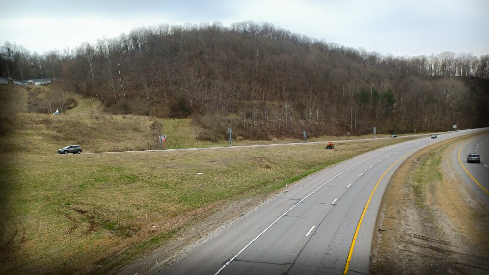
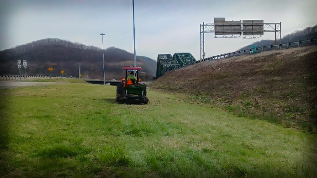
Highway Pollinator Planting and Management
We will also be traveling across the great state of West Virginia for a pollinator mitigation planting project which will cover more than 130 acres. We will be planting a variety of native flowers using a no-till drill and following up with invasive monitoring and management. AllStar Ecology will maintain the new planting sites for 3 years, after which we will train the new stewards to take over. Be sure to keep your eyes out for signs along interstates and highways next year, but maybe don’t stop to smell the flowers.
Pipeline Right-of-Way Archaeological Survey
The AllStar Ecology Archaeology crew conducted a Phase I archaeological survey in Marshall County along a 1.9 acre proposed pipeline right-of-way. Due to a previously identified archaeological site adjacent to the proposed pipeline, we were contracted as part of their due diligence to protect potential culturally significant land. Alternative routes for the pipeline have been considered in the event that the site meets the threshold for protection. Once a thorough investigation has been conducted, a report detailing recommendations for classification will be submitted to WVSHPO for review.
by Charity Moore Norton | Aug 10, 2021 | Cultural Resources, News, Volunteerism
Since 2019, one of AllStar Ecology’s cultural resource management (CRM) staff has volunteered ocassionally as an archaeology correspondent for the West Virginia Explorer. The West Virginia Explorer is an online magazine designed to “investigate West Virginia and its natural and cultural resources.”
The collaboration started in response to an open letter by the Council for West Virginia Archaeology (CWVA), which highlighted issues with popular – but unfounded – assumptions about archaeology and prehistory. Ms. Norton partnered with WV Explorer’s editor, David Sibray, to write a number of articles with scientifically-sound evidence and professionally-qualified interpretations. In the process of writing these articles she interviewed various personnel from state and regional organizations. These included the West Virginia State Historic Preservation Office (WV SHPO), Grave Creek Mound Archaeological Complex, and the CWVA. With their help, she was able to gather information on topics such as historical rock piles, how to document a new archaeological site, and myths about mound builders and giants.
You can read a few of her articles by following the links below:
West Virginia Explorer Articles
by Charity Moore Norton | Jul 9, 2021 | Cultural Resources, News, Permitting
The law may require that your project is evaluated for impacts to archaeology, cemeteries, old architecture, historic viewsheds, etc. Often called “Section 106 review,” this process involves consultation with the State Historic Preservation Office (SHPO), who may request a Phase I archaeological survey, architectural reconnaissance survey, or for you to evaluate historic properties.
Only a professionally qualified cultural resource management (CRM) consultant can fully navigate the Section 106 process, but here are a few basics that YOU should know.
- Section 106 is part of the National Historic Preservation Act (NHPA), which regulates projects with a “federal nexus.” Such projects are defined as an “undertaking” and are triggered by permits, land, funding, jurisdiction, or any other direct involvement from a federal agency. One of the most common is a Nationwide Permit from the U.S. Army Corps of Engineers.
- When an undertaking could impact a “historic property,” a Section 106 review helps government agencies to manage or mitigate impacts in a responsible way. This consultation requirement cannot stop development or force preservation, but all of the steps must be completed according to federal and SHPO guidelines. Click here for a printable flowchart of the Section 106 process.
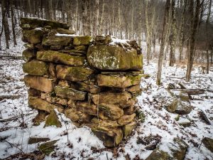
- Cultural resources must meet one of the National Register of Historic Places (NRHP) eligibility criteria to be considered “historic properties.” They usually must be more than 50 years old and can include archaeological sites, houses and other architecture, farmsteads, historic areas, bridges, cemeteries, rock walls, etc. If a cultural resource fails to meet one of the NRHP criteria, they must still be documented for due diligence.
- State Historic Preservation Offices (SHPOs) advise government agencies on how to comply with Section 106, make recommendations for archaeological or architectural surveys, and provide expert opinions about which cultural resources may be impacted and/or NRHP-eligible. Although a CRM consultant can make professional recommendations, only SHPO and the involved agencies make final determinations.
- Historic properties are uncommon; however, agencies often require due-diligence background research and surveys to check for undocumented cultural resources. Most areas have never had a historic survey, so boots-on-the-ground is generally the only way to clear a project area. Archaeology is particularly challenging, since most resources are invisible below the ground surface.
- Regulated impacts are limited to changes to a historic property that negatively affects its NRHP-eligibility. However, agencies often focus on physical disturbance (direct effect) and alterations to the property’s viewshed, including newly-built aboveground components and tree-clearing (indirect effect). Not all indirect effects are considered “adverse effects” and even adverse effects can be minimized or mitigated.
You can learn more about the federal review process in the ACHP’s “A Citizen’s Guide to Section 106 Review” here and more about the WV SHPO’s specific guidelines here.
by Charity Moore Norton | Apr 2, 2018 | Cultural Resources, News
The Naming of Rover’s Run and Bear Knob
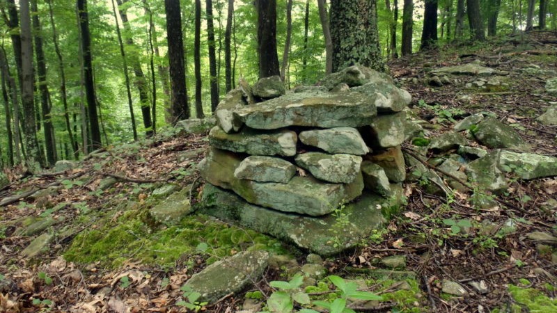
At the western edge of Upshur County lies a small perennial stream called Rover’s Run. This stream derives its name from a case of mistaken identity, according to Lucullus Virgil McWhorter, an amateur archaeologist, author of a 1915 book on the history of Hacker’s Creek, and later Western pioneer who grew up nearby. McWhorter describes his grandfather and a friend’s (John Edmonds) hunting trip. As they traveled through the unbroken forest, Mr. Edmonds spied a wolf off in the distance. After taking the shot, he approached the dead animal, only to find that he had killed his favorite dog, Rover.
Like the rest of the Hackers Creek watershed, this stream runs through a deep valley surrounded by steep, narrow ridges. One of the overlooking ridgetops, which also happens to be the tallest point in the watershed, is identified on old maps as “Bear Knob.” This name comes from another hunting anecdote from the mid-1800s, also recorded by McWhorter. After a hog was taken from a farm, Isaac Reger took a rifle and hunting dogs to track down the offending bear. His dogs chased the bear into a tree on the tall knob, allowing Mr. Reger to take his revenge. The knob had formerly been known as “Potato Knob,” due to its profile’s similarity to a potato mound, and later became a popular site for Easter parties.
The Role of Archaeology and History
Although McWhorter is considered to be a reliable source, his information is based on oral tradition. This is often the case in local history, which mixes hearsay, “fish stories,” and half-remembered events that are much more colorful than the dry government records and genealogies that scholars use to research the past. While we may never know where Rover actually died, or if a hungry bear was really a defining local moment, archaeology can give us a science-based look into the everyday lives of past individuals. History can tell us Mr. Smith lived in the year eighteen-something, but archaeology can tell us that he had a habit of smoking with a horn pipe and that his wife bought her dishes from the city instead of the local general store. On a bigger scale, archaeology can answer questions about socio-economic status, farmstead layout, and other topics that don’t always make it into written records.

Phase I and II Survey Results
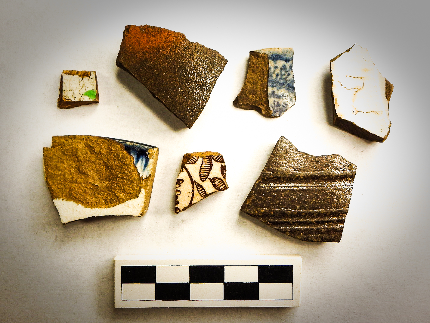
In November 2014, AllStar Ecology began an archaeological survey of the Bear Knob Property, which includes both Rover’s Run and Bear Knob. A total of 738 artifacts were collected, including Native American tools and pottery, a horseshoe, possible lead shot, and fragments of dishes and bottles from early European-American settlers. These artifacts belonged to 12 different archaeological sites and may span as much as ten thousand years, providing a unique look at human history within a single West Virginia valley. These resources included isolated lithics, scatters of prehistoric artifacts, historic-period debris scatters associated with old houses, and a group of interesting rock piles.
Historical Research Results
As AllStar Ecology’s Archaeologists began to study the artifacts and relate them to historical documents, the story of an early West Virginia family began to emerge. Instead of just reading about the Lawmans, Bonds, and other inhabitants of the hollow, we were holding the physical representations of their lives and actions. According to a descendant, William Lawman and his father Barnhard built a log cabin at the head of Rover’s Run in the 1860s, matching the interpretations of survey findings. Along with an older brother, William fought for the Union during the Civil War, while Barnhard and his 10-year-old son fought for the Confederacy. The latter two moved to a neighboring hollow after the war and a path between the two is visible in aerial imagery. The remains of their homes were studied and can contribute to our understanding of daily life during this difficult period in history.
The Future of the Bear Knob Property
Many of the identified cultural resources will be preserved within an aquatic resource mitigation bank to be constructed on the property, which will allow for their future access by archaeologists, perhaps as part of mitigation for another project. The Bear Knob Property survey was a unique experience for AllStar Ecology, as it uniquely shed light on the history of an entire hollow and provided an example of how cultural resource management can benefit from mitigation banking.